"Smart Growth" and "New Urbanism" Compared with "Large Lot Zoning" (Tom Lane) [ Home Page – Click Here]
(May 17, 2017) – Traditional "Large Lot Zoning" is "Greener" than "Smart Growth" within Urban Growth Boundaries . . . Copyright 2009 – 2017 . . . Tom Lane . . . Photographing California, Arizona, Nevada, New Mexico, Colorado, Utah, Oregon, and Seattle, Washington.
Salt Lake City – Legacy Parkway – A Green Solution for Seattle Gridlock
(Tom Lane, May 22, 2012) Is light rail (mass transit) the best solution for Seattle’s gridlock, when it will only reduce only 3% of all trips? Or, are more freeway lanes the best answer? How about more bike paths? Salt Lake City’s new Legacy Parkway combines more lanes and a bike path, and even includes protected wetland areas for wildlife.
Congestion on I-15 was reduced by 20% after the 15 mile parkway was completed in 2008. The Legacy Parkway is a “green” freeway, and representatives the future of highway construction in the country. It will be expanded northward, as discussed in this article in The Desert News. The Legacy Parkway could be used as a model for desperately needed new freeways in the Seattle area, as proposed by Dr. Bill Eager; click here for my post on Eager’s engineering plans for Seattle..

Legacy Parkway, Looking south.
Salt Lake City and Seattle – Similar North-South Trending Freeway Systems
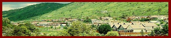
Both Salt Lake City and Seattle feature north-south trending freeways, with north-sound trending mountains constraining development on both sides of the cities. The Great Salt Lake and Utah Lake just west of Salt Lake City are analogous to Puget Sound just west of Seattle. Below, a view of Bountiful, Utah and the Great Salt Lake, looking west from a road near the Bountiful LDS (Mormon) Temple. If you zoom in, the north-trending Legacy Parkway is the furthest freeway to the west, before the wetlands and the Great Salt Lake:

Looking west from a residential area in Bountiful towards the Great Salt Lake. The Legacy Parkway is the furthest development to the west before the wetlands.
The existing interstates in both cities (I-15 in Salt Lake City and I-5 in Seattle) have been widened to accommodate population growth. Loop freeways parallel to the interstates provide additional congestion relief in both cities – I-215 in Salt Lake City, and I-405 in Seattle.
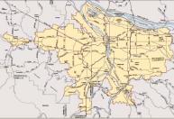
Here’s a map of most of the Salt Lake City metro. A map of the Seattle metro appears several paragraphs below. Below, the arrow points to the 15 mile Legacy Parkway, parallel to I-15, and terminating at I-215. Click here for this same map in PDF format.

The arrow points to the Legacy Parkway.
As population growth continues, additional parallel arterials are required to prevent the costs of widening interstate highways to ridiculous widths. While Salt Lake City and Seattle have numerous parallel arterials, both metros will continue to widen their existing freeways, and add more loop highways.
Currently, Salt Lake City is widening I-15 between Lehi and Spanish Fork, to meet the transportation needs through 2030: http://www.i15core.utah.gov/project_information.php

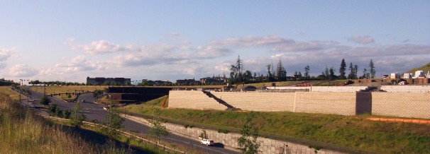
Legacy Parkway, Overpass, and view of the Salt Lake City skyline under the overpass (opposite lane).

Salt Lake City Legacy Parkway map from UDOT.
The Legacy Parkway and Preserve
The Legacy Parkway (SR-67) is a 4 lane freeway with four lanes parallel to I-15 between North Salt Lake and Farmington, north of I-215, and west of I-15, Bountiful, Centerville, and Woods Cross. The parkway features an adjacent bike path, nature preserve, and nature center.
The Legacy Parkway has reduced congestion on parallel route I-15 by 20%. From the UDOT web site –
“Interstate 15 through Davis County hosted upwards of 150,000 vehicles each day before the Legacy Parkway was completed.
Since the Parkway opened to traffic it is estimated that traffic on I-15, between the U.S. 89/Legacy Parkway/I-15 interchange in Farmington and the I-215 exit in North Salt Lake, has been consistently reduced as much as 20 percent.
Additionally, the Parkway provides a unique “escape route” from the Salt Lake City area northward, when accidents, construction, or other events significantly slows, or even closes I-15.”

Bike paths and wetlands near the Parkway..
Unique Features of the Parkway – The First of its Kind in the US
From the UDOT web site –
“A new western-style parkway: Legacy Parkway is the first of its kind in the United States and includes many unique elements:
- Gateways to introduce motorists to the Parkway and surrounding communities
- Meandering roadway instead of a traditional fixed, straight freeway design
- Unique landscaping
- Unusual structural design features including bridge monuments and barriers
- Independent multi-use and equestrian trails alongside the Parkway
- “Greenways” that blurs the boundary between the Parkway and community
- Lower overall speed limit provides a pastoral driving experience
- Commercial trucks of five axles or 80,000 RGVW are generally prohibited from using the Parkway. But thanks to special signage on I-15 and I-215, they are able to use it during special traffic emergencies.
- The Legacy Parkway was designed and built to respond to our SEIS commitment, to avoid as much wetland impact as possible, as well as our negotiated agreement to create a unique Parkway look and feel.

Legacy Parkway wetlands and trails.
Legacy Nature Preserve
From the Legacy Preserve web site
“The Legacy Nature Preserve is a 2,225-acre wildlife preserve on the southeastern shore of the Great Salt Lake. Established as environmental mitigation for the Legacy Parkway Project, the Preserve helps prevent encroachment of future development into this portion of the Great Salt Lake Ecosystem by restoring a mosaic of different wetland and upland habitats that are important for a myriad of wildlife species, especially migratory birds.”

Legacy Parkway nature area, handicap path, benches.
The Legacy Parkway – Great Idea for Seattle’s SR-18 and the Snoqualmie Valley (I-605)
Currently, Seattle gridlock is intolerable on three clogged north-south parallel freeways – I-5, I-405, and SR-167. Originally, SR-18 was supposed to be widened to divert traffic from Tacoma (via Auburn) to I-90 near Snoqualmie. And, I-605 was supposed to be constructed from Snoqualmie north to Mill Creek. Right now, in some areas, SR-18 is only one or two lanes in each direction, with an intermittent divider, and resulting dangerous conditions for truckers going from Tacoma to Spokane.
Dr. Eager proposes making SR-18 a four lane divided highway, with additional climbing lanes in each direction towards the Tiger Mountain Summit. Currently, dangerous conditions exist at the summit, with an intermittent divider:

Intermittent divider and dangerous conditions on SR-18 over the Tiger Mountain summit.
Dr. Eager proposes the new I-605 through the Snoqualmie Valley, from Snoqualmie to Mill Creek (parallel to the existing and congested SR-203. I-605 would serve as a parallel alternative to I-405, diverting travelers and truckers bound for Everett and Canada from entering Bellevue on I-405, and vice versa for those heading to eastern Washington and beyond.
I-605 would also reduce congestion during commute hours on SR-203 through Duvall, Fall City, and Snoqualmie. In fact, those who advocate “smart growth” should really favor I-605, given that the main road through the prestigious smart growth “Snoqualmie Ridge” development is used as a shortcut for commuters avoiding I-405. In addition, downtown Duvall has a smart growth towne center that is inaccessible during the afternoon commute –

Duvall, Washington Towne Center congestion during commute hours. Fails the smart growth tests of bike and pedestrian friendliness, since planners have failed to build the adjacent I-605.
Both SR-18 and SR-203 run through wetlands in the Green and Snoqualmie Valleys (similar to the Legacy parkway). Adjacent “country roads” function as popular bike routes, however, they often have no shoulders, and are clogged with traffic that should be running on the overdue freeways. Many of these roads now support small businesses for those stuck in gridlock, who don’t have access to a freeway for their commute:

Java Cup barn on SR-203. The new I-605 would be west of here, since this two lane road serves several cities including Duvall, Fall City, and Carnation, along with several farms.
Therefore, freeways similar to the “Legacy Parkway,” with adjacent bike paths and nature preserves in river wetlands, could be constructed as I-605 and SR-203. Imagine the popularity of a bike path extending from the Weyerhauser Headquarters in Federal Way, all the way through Auburn, then meeting existing trails in the Tiger Mountain State forest, then to trails in the Mountains to Sound Greenway along I-90, and finally through the Snoqualmie Valley.
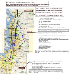
Seattle can learn from the Legacy Parkway to complete Dr. Eager’s “End Gridlock Now” map. On the map below, SR-18, green, and I-605, dashed blue, are parallel freeways to I-5 and I-405, located to the far right on this map, nearly to the eastern edge of the metro (beyond most of the urban growth boundary). Click here for my post discussing Dr. Eager’s “End Gridlock Now.”
Similar Photos – Legacy Parkway and the Snoqualmie Valley
Note how these two photos are similar. The first is looking north on the Legacy Parkway, with the bike lane, horse farms, and distant mountains. The second is looking north, standing on the Duvall, Washington Urban Growth Boundary, looking down towards the existing two lane SR-203.
Imagine transforming the Snoqualmie Valley into a four lane freeway similar to the Legacy Parkway. This would take trucks off of I-405, with a bike path extending north to Mill Creek and south to the Tiger Mountain Summit and ultimately to the Weyerhauser Campus in Federal Way!
Imagine the popularity of this trail, and the possibility of bike races in a temperate climate. Imagine the congestion reduction on both I-5 and I-405, as travelers bound for Canada, Spokane, Boise, Tacoma, and even 800 miles to Salt Lake City, no longer have to use these narrow, congested Interstates.

Looking north towards the Salt Lake City Legacy Parkway with adjacent bike trail, horses, and distant suburbia with mountains.

Do you see how this area of the Snoqualmie Valley near Seattle, could be transformed to the Legacy Parkway in Salt Lake City, with a bike path and nature preserve? This is looking north standing on the City of Duvall Urban Growth Boundary.
Map of Dr. Eager’s “End Gridlok Now” for Metro Seattle
CLICK MAP to ENLARGE within your web browser – Dr. Bill Eager – “End Gridlock Now” –

CLICK MAP to ENLARGE within your web browser. End Gridlock Now. Dr. Bill Eager, Seattle, Wa.

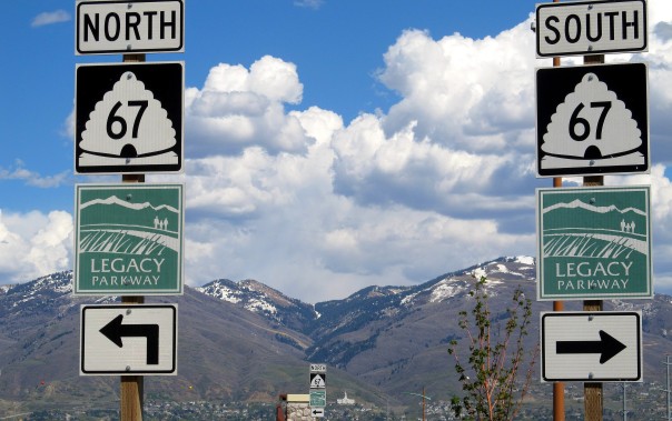
Legacy Parkway sign.

Legacy Parkway signs. Bountiful, Utah LDS (Mormon) Temple in the distance.

Legacy parkway Bike path tunnel.

Trail crossing the Legacy Parkway.
–

Legacy Parkway Sign.

Bike trail and cyclists next to the Legacy Parkway.

Southbound on the Legacy Parkway approaching I-215.

Traffic on I-15, running parallel to the Legacy Parkway (north to south), was reduced by 20% after construction of the 15 mile Parkway in 2008.

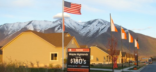
Sign for affordable housing along the Parkway, starting in the 160’s, since the Salt Lake City metro does not have an Urban Growth Boundary, in contrast to Seattle, Portland, Denver, Bend, Boulder, coastal California cities, etc.

Bountiful, Utah LDS Temple. Bountiful offers affordable housing on large lots, along with a diversity of retail and restaurant choices, with convenient access to Salt Lake City on either I-15 or the parallel Legacy Parkway.

I, Tom Lane, pledge to always be the “Voice of Independence,” in a world dominated by “true believers,” of the ephemeral, and very unpopular, urban planning paradigm, of “smart growth.” I will always advocate family friendly, green neighborhood design, with large private yards, oversized parks, organic gardens, mountain bike trails, and native plants protected by ordinance. Everything must be in harmony with nature, in the grand traditions of designers Ian McHarg and Frank Lloyd Wright.”
Professors Against Smart Growth and Light Rail – The List Continues to Grow – Both Democrats and Republicans –
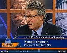
NEW VIDEO – One Hour – October 10, 2011 – Kemper Freeman and Tim Eyman with Seattle Times Editorial Board –

NEW VIDEO – October 8, 2011 – Kemper Freeman on TV-W “If You Drive Vote Yes on I-1125”
Watch Kemper Freeman Traffic Video In His Own Words – 10 Minutes
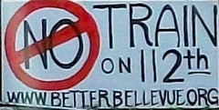
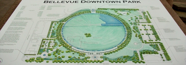
Kemper Freeman and Bellevue Residents Willl Stop Light Rail. – CLICK HERE for “Building a Better Bellevue” –
Kemper Freeman Sues Sound Transit over Light Rail in Seattle – Click Here to Find Out Why –
NEW! Kemper Freeman’s 2011 Electric Car Charging Stations at Bellevue Square. *CLICK IMAGE* for Photos and Videos.
More Photos on Tom Lane's Flickr Yahoo Photo Account -

Dr. Peter Gordon’s Blog (USC) on Smart Growth and Light Rail –

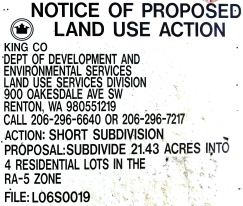
How King County Makes Housing Unaffordable, and Punishes Farmers Outside the Urban Growth Boundary –
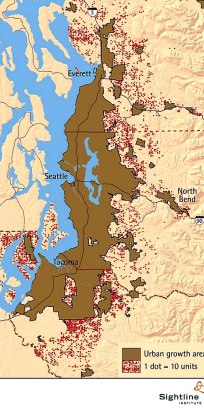
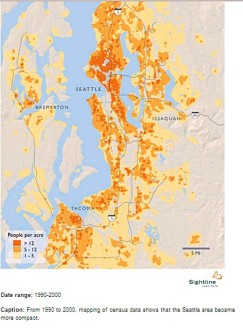
Seattle Urban Growth Boundary Does Not Work – Each dot is 10 building pemits, 1991-2001 – 46,000 total – outside the brown PSRC Urban Growth Area in the Seattle metro. CLICK to enlarge, from Sightline of Seattle, Wa.
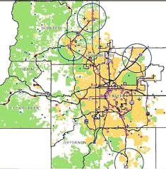
Metro Denver Urban Growth Boundary (“Metro Vision 2035”) – CLICK to Enlarge, from Denver Regional Council of Governments (DRCOG) –
Portland Metro Urban Growth Boundary as of 2006 – CLICK to Enlarge, from Metro of Portland –
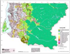
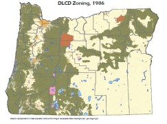
Oregon DLCD Statewide Zoning Map. Hasn’t changed since 1986.
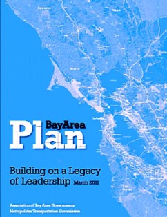
“Plan Bay Area” – High Density Smart Growth Plan – Association of Bay Area Governments
More Growth Maps Below, and from Sightline of Seattle – CLICK HERE –

Recommended Reading – Sprawl A Compact History – Dr. Robert Breugmann, Univ. of Illinois –
Recommended Reading: The Essential Frank Lloyd Wright, Bruce Brooks Pfeiffer, Ed. 464pp. for $18 on amazon

The Greener Alternative to High Density Treeless Smart Growth – Conservation Subdivisions – book by Randall Arendt
Recommened Reading on Land Use Economics and Growth Management: “The Homevoter Hypothesis…” by Dr. William Fischel of Dartmouth –

Classic 1979 Book on Anti-Growth Restrictions in California Blocking Middle Class Homes – the late Dr. Bernard Frieden – The Environmental Protection Hustle, MIT Press –
Somerset – Active Bellevue, Wa. Neighborhood Association – Incredible Views – Click for Map of Properties –
Click Image for Randall Arendt and Conservation Subdivisions – Alternative to High Density Smart Growth and Traditional Sprawl –
Seattle area Urban Growth Boundary from Seattle – Puget Sound Regional Council, Regional Smart Growth and Urban Growth Boundary, “Vision 2040” – CLICK to Enlarge –

Outside Seattle’s Urban Growth Boundary, New Homes Must be on Five Acres:
Seattle area Population Density Contained within Urban Growth Boundary – CLICK to Enlarge, from Sightline of Seattle –
Cargo Cycling Video – Click Image –
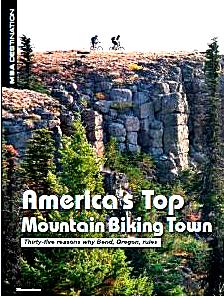
Bend, Oregon: Best City for Mountain Biking, FREE PDF Article from Mountain Bike Action magazine. CLICK HERE –
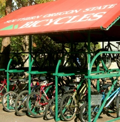
Ashland, Oregon: Southern Oregon University Bicycle Covers. Great idea.
Ashland #1 for Trail Running: Outside Magazine for 2010:

Bend Philanthropic Mountain Bike Trailbuilding: Central Oregon Trail Alliance –
Internation Mountain Biking Association – IMBA – Philanthropic Trailbuilding –
Mountain Bike Review Regional Discussion Boards – Click Image –

Mountains to Sound Greenway: 100 Miles of Trails on I-90 from Seattle to Thorp, Washington in Eastern Wa.

“Friends of the Trail” in Washington State: Volunteers Help Local Agencies Clean Up Waste on Trails, and Even Underwater –

Bob Brinker and Dr. Bill Wattenburg, Click Feb. 2009 Ad for President Obama in the Washington Post –

Gas for $2 a Gallon – With Natural Gas – Write President Obama – Click for Letter from Bill Wattenburg

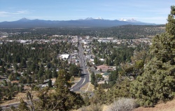
Why Bend, Boulder, Ashland, & Durango will Keep Growing: 5 Million Baby Boomers Moving to Rural Areas by 2020. PDF of USDA Report – Click here –
Familiar landmark, at an undisclosed location, in the Mojave Desert somewhere between Phoenix and Los Angeles.
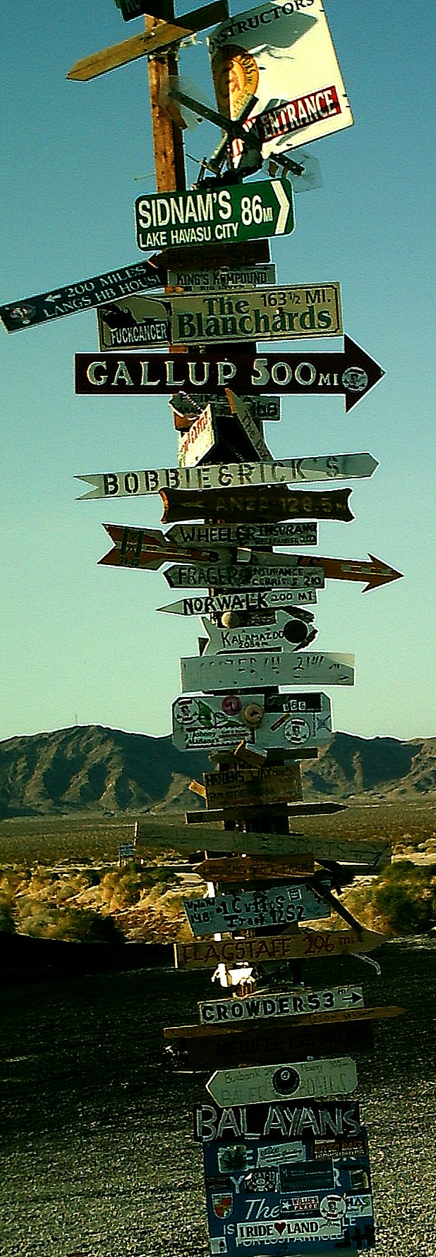
Click to enlarge.
Trillium –
My mission – Affordable Single Family Detatched Housing on Acreage for Everyone –

I also support affordable detatched housing for the GLBT community. CLICK IMAGE for the Human Rights Campaign –

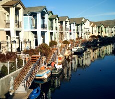
*HOME PAGE* – Click Image of the Sparks Marina near Reno, NV. for the HOME PAGE –
Cancel Obama’s Expensive Smart Growth in 2012 – Mark Levin for President – Housing Affordability for Everyone –

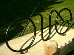
It’s a Bike Rack –
Rio Rancho and Albuquerque, New Mexico. NO URBAN GROWTH BOUNDARIES = AFFORDABLE HOUSING
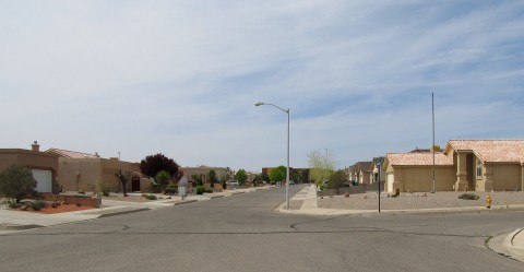
Salt Lake City – Rio Rancho, New Mexico – NO Urban Growth Boundary = AFFORDABLE HOUSING on LARGE LOTS – More Photos Forthcoming
Mysterious Massive Walls and Clearcutting at Issaquah Highlands … vs. Green Neighborhoods in Arizona and Oregon … Click Here …
Durango Smart Growth – La Plata County Comprehensive Plan – Cancelled (Nov. 23, 2011) – CLICK IMAGE for Plan Maps and Photos –
* NEW * October 8, 2011, Seattle – KEMPER FREEMAN VIDEO – If You Drive, Vote YES on I-1125, Kemper Freeman on TV-W w/ Doug MacDonald

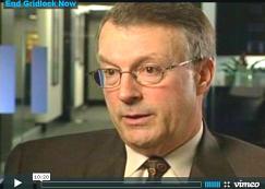
Dr. Bill Eager – “End Gridlock Now” – Stop Seattle Gridlock Today
Kemper Freeman Sues a Third Time over Seattle Light Rail – May 9, 2012
SEATTLE – Why Washington’s Anti-Tolling and Anti-Transit Initiative (I-1125) Didn’t Pass (12/6/11) – CLICK IMAGE of the skyline from West Seattle –

* HEY SEATTLE * – VOTE YES on Kemper Freeman’s Initiative I-1125 – Protect Your Gas Taxes and Tolls – Stop Illegal East Link I-90 Light Rail – Stop the Destruction of Downtown Bellevue with an Ugly Transit Oriented Development -CLICK HERE –

Salt Lake City’s Legacy Parkway – A Green Solution for Seattle Gridlock
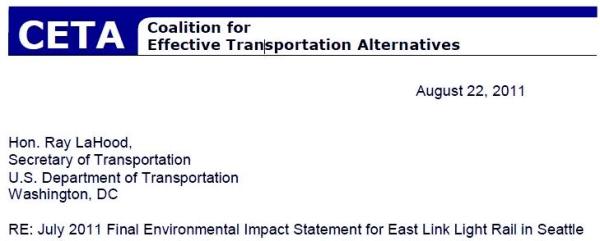
*CETA* Coalition for Effective Transportation Alternatives (Seattle) – John Niles – August 22, 2011 Letter to Ray La Hood advocates Bus Rapid Transit on I-90
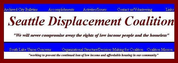
* SEATTLE DISPLACEMENT COALITION * – John Fox and Carolee Colter – Defending Lower Income Apartment Residents against Greedy Smart Growth Developers and Seattle Politicians – CLICK HERE for web site & columns –
*GREEN ALTERNATIVE * to Smart Growth – *WATCH VIDEO* from Pique Architects – Do They Present Something SIMILAR to the “LANDSCAPE URBANISM” Concept of Harvard’s Dr. Charles Waldheim? Image Source: http://vimeo.com/user4133046/videos – Pique LLC of Bend, Seattle, & Montana –
* SMART GROWTH * – The Wolf at Your Front Door – You Tube – (5 Minutes) – Image Source: http://www.youtube.com/user/regsgridlock –
Stop Obama’s Smart Growth … Preserve Organic Farms and Parks on Acreage … We Have No Choice but to Vote Republican … The Truth from Talk Host Mark Levin … Defending Private Property Rights Every Day – Coast to Coast, 3P-6P, Pacific … CLICK for Free Archives.