"Smart Growth" and "New Urbanism" Compared with "Large Lot Zoning" (Tom Lane) [ Home Page – Click Here]
(May 17, 2017) – Traditional "Large Lot Zoning" is "Greener" than "Smart Growth" within Urban Growth Boundaries . . . Copyright 2009 – 2017 . . . Tom Lane . . . Photographing California, Arizona, Nevada, New Mexico, Colorado, Utah, Oregon, and Seattle, Washington.
Rio Rancho, New Mexico – Affordable Housing from No Urban Growth Boundary
(May 24, 2012, Tom Lane) Rio Rancho, New Mexico, “The City of Vision,” is a large suburb just northwest of Albuquerque in Sandoval County. Neither Rio Rancho nor Albuquerque have urban growth boundaries.
The City has was originally planned decades ago, with a grid pattern consisting of wide streets and half acre lots. Most of the land remains undeveloped, along with privately owned rangeland beyond the City limits within unincorporated Sandoval County.
The Rio Rancho U.S. census 2010 population is 88,000, and increased from 51,000 in 2000 – a 44% increase. I would estimate that this could easily increase to a few hundred thousand within three decades, if the private rangeland continues to develop, and is ultimately annexed to the City.
Sandoval County’s 2000 population was 89,000 in 2000, and 132,000, an increase of 46%.
History and Future of Rio Rancho
Land developer AMREP bought nearlly 100,000 acres in Rio Rancho in the 1960’s and 1970’s. According to their web site:
“Rio Rancho Estates” consists of over 91,000 contiguous acres in Sandoval County, New Mexico, near Albuquerque, of which some 73,725 acres have been platted into approximately 114,500 homesite and commercial lots and 16,450 acres are dedicated to community facilities, roads and drainage with the remainder consisting of unplatted land … Rio Rancho is the fastest growing “Metropolitan” area in the United States … The City is directly in the path of Albuquerque Metro growth … Gross receipts = 40% to 50% of the city tax revenue … Favorable regulatory, tax, and political environment … Among the lowest per capita combined tax rate in state … Excellent quality of life, including affordable housing and low crime rate; Excellent school system.”
Since AMREP has platted 114,000 homesites, and the 2010 U.S. Census measured the average home size of 2.7 individuals, this would certainly be a population of 308,000, in addition to new residents in Sandoval County. The population of Sandoval County could easily approach 500,000 within three decades.
AMREP Land for Sale can be viewed at this link, from maps and aerial photos.
Stable Home Prices for 10 Years on Trulia
Due to plenty of inexpensive privately owned rangeland with no urban growth boundaries, supply has kept up with demand for single family, detached products in Rio Rancho, and neighborhing Albuquerque. The median sales price for a home in Albuquerque (on Trulia) was $133,000 in April, 2012, compared to $100,000 in January, 2000.
The median sales price for Rio Rancho was $214,000 in April, 2012, higher than Albuquerque, perhaps since Rio Rancho’s median income is $48,000 compared to $38,000 in Albuquerque, reflecting Rio Rancho’s high tech employers, including Sprint, Intel, Hewlett Packward, and others (see below). Note that data for Rio Rancho in 2000 median home prices (on Trulia) was not available.
Land also remains inexpensive since state and federal lands do not surround most of the Albuquerque – Rio Rancho metro. This contrasts with Phoenix, Flagstaff, Las Vegas, NV, and Reno, NV, where various combinations of federal (USFS, BLM) and state lands form “artificial” urban growth boundaries, resulting in a scarcity of developable land.
Indeed, Rio Rancho’s “indefinite expansion” is similar to Salt Lake City, Utah, where privately owned land in both markets, on the suburban fringe, is sold to developers at market rates, never inflated by urban growth boundaries.
For both the greater Albuquerque and Salt Lake City markets, of course, the exceptions are nearby lands owned by the USFS, such as the Sandia and Manzano Mountains east of Albuquerque, and the Wasatch Front east of Salt Lake City. And, the Native American Pueblos block development to the north of the Albuquerque-Rio Rancho metro, and also to the distant west and south. However, none of these geographic constraints prevent significant suburban growth in other directions.
Additional information on the Albuquerque-Rio Rancho market and its amazing affordability is found at my other post: https://smartgrowthusa.wordpress.com/2011/02/12/albuquerque-santa-fe-new-mexico-impact-fees-smart-growth/

Development in northern Rio Rancho along with plenty of vacant land.

Rio Rancho, New Mexico.
New Mexico vs. Las Vegas, NV – Why Albuquerque-Rio Rancho Has Always Been Affordable
Neither Las Vegas, NV or Albuquerque-Rio Rancho have urban growth boundaries. However, unlike central New Mexico, Las Vegas, NV has federal land — creating a scarcity of developable land on the urban fringe.
Due to this land shortage, land auctioned for over $300,000 per acre, just before the housing crash, resulting in unaffordable housing, and the bubble. See the quote from Dr. Wendell Cox below.
The same thing happened with auctioning of private land in Bend, Oregon, due to the state imposed Urban Growth Boundary. However, speculation has never been a part of land transactions in Albuquerque, and this is discussed in my post on New Mexico’s Mid Region Council of Governments.
Dr. Wendell Cox writes about the horrible Las Vegas scenario with land auction prices at $300,000 an acre, from his web site “Urban Tours by Rental Car,” and his 2006 photo essay (before the crash) entitled, “Las Vegas: Playground To the World.”
“As late as the early 2000s, Las Vegas was an affordable housing market, with median house prices approximately three times median household incomes. However, as development has continued, the supply of privately owned land on the periphery has declined. Most of the developable land was owned by the federal government, which has historically sold land to developers to accommodate Las Vegas’ growth.
However, since 2001 land sales have been limited due to environmental concerns. Recent federal auctions have obtained more than $300,000 per acre. The federal government itself has been surprised at this, having anticipated only one-eighth the sales revenues. This land scarcity premium has driven the price of housing up and Las Vegas is now among the most unaffordable housing markets in the United States.
Thus, while Las Vegas does not generally practice “smart growth” or “urban containment” per se, the effect of government policies—federal auctions and Boulder City preservation—is the same.”
Here’s a 2008 land use map and constraints to buildable land within the Albuquerque-Rio Rancho metro. CLICK to ENLARGE within your web browser.

CLICK to ENLARGE within your Web Browser – Central New Mexico Land Use and Buildable Land Constraints, from MRCOG, the Mid Region Council of Governments.
An Afternoon Drive through Rio Rancho
All of the photos below can be seen in a four hour trip through Albuquerque and Rio Rancho. You’ll need a 4WD vehicle to travel westward beyond the Rio Rancho city limits on undeveloped dirt roads, in order to truly appreciate how much developable land exists on privately owned rangeland extending for miles. Watch out for off road vehicles.
Ultimately, I’d estimate that the entire area you’ll drive around could easily support 300,000 persons, at an average residential density of 0.75dU/acre (three quarter acre lots). There are numerous quarter acre and half acre lots for sale. Search Craigs List for amazing deals.
First, we’ll look WESTWARD towards Rio Rancho from the NE Heights in Albuquerque. Rio Rancho is on the distant plain on the other side of the Rio Grande valley. If you zoom in by clicking within your web browser, you’ll find the new Rio Rancho City Center buildings (City Hall, Hewlett Packard, Santa Ana Casino offices, UNM-West, CNM, etc.).

From Albuquerque’s NE Heights, looking WNW towards Rio Rancho. CLICK to ENLARGE within your web browser to find the multi-story buildings in the Rio Rancho City Center.

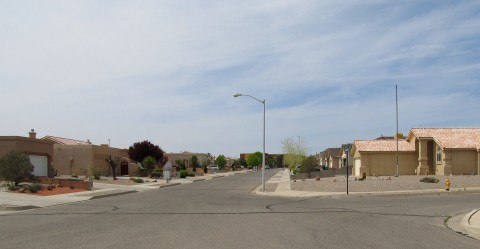
Typical Rio Rancho wide street with Southwestern Style homes and “gravelscaping” to keep the dust down. (I’d prefer native plants.)

Pedestrian, Bike and Family Friendly, and Affordable.

Another typical street.

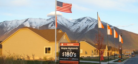
Nice, safe, walled neighborhoods with gravelscaping. Rio Rancho homes starting in the mid-100’s – similar to new home price signs in Salt Lake City, another market without an Urban Growth Boundary.

Rio Rancho Low 100’s – Great Deal !

North edge of Rio Rancho. Development can still occur behind where I’m standing. Note the wide street, safe for cycling and pedestrians, and also safe for children walking to the nearby new elementary school.

Half acre lots for sale. And there also acre lots for sale. You would never see large lots for sale in a “smart growth” area with urban growth boundaries !

Rio Rancho City Center, still under development.

Rio Rancho City Hall. Have no idea what the City Councilor is hiding. The City looks fine to me, a lot better than Albuquerque and Santa Fe. Yes, she is right, people should give her a call and stop posting silly signs that clutter the clean gravelscaping.

In the City Center, UNM-West (Univ. of New Mexico).

New UNM Hospital in the City Center. There’s also a new Presbyterian Hospital in Rio Rancho. The City is very business friendly and WANTS to grow.

Rio Rancho CNM in the City Center.

Rio Rancho City Center Santa Ana Casino Offices.

New Hewlett Packard offices. Other high tech employers include Sprint and an Intel Manufacturing Plant.
Journey from Rio Rancho to Rangeland of Unincorporated Sandoval County
As described above, this route going west on Southern Boulevard gives you a sense of how much developable land is available both inside, and outside of the City Limits.
Warning: Due to very soft soil conditions, you must have a 4WD to see the dirt roads. Watch out for All Terrain Vehicles who will go faster than you can drive your 4WD. DO NOT attempt this during thunderstorms and flash floods.

Full service ~200 foot right of way for Southern Boulevard before it narrows as we drive westward.

Southern Boulevard is initially well over 100 feet wide, gradually narrowing to three lanes, and then two lanes, prior to leaving the City Limits. The right of way, shown here, remains at over 100 feet wide, before leaving the existing City limits.

Rio Rancho City Limits, with miles of undeveloped land to the west in unincorporated Sandoval County, outside the City Limits

Down to two lanes, and leaving the City Limits for unincorporated Sandoval County.

From near the City Limits, looking south to Albuquerque and the Petroglyths National Monument. There is plenty of land for development, before the national monument begins.

Looking eastward from just outside the City Limits on the grid network of dirt roads towards the Sandia Mountains.

Another view to the Sandia from the (Dangerous!) Off Road Vehicle parking lot where NOBODY is watching out for you !

All Terrain Vehicles destroy the topsoil and kill native cacti and junipers. NOBODY is watching out for them, unless you and I buy a couple of acres and start a native plant nursery!

One comment on “Rio Rancho, New Mexico – Affordable Housing from No Urban Growth Boundary”
Leave a comment

I, Tom Lane, pledge to always be the “Voice of Independence,” in a world dominated by “true believers,” of the ephemeral, and very unpopular, urban planning paradigm, of “smart growth.” I will always advocate family friendly, green neighborhood design, with large private yards, oversized parks, organic gardens, mountain bike trails, and native plants protected by ordinance. Everything must be in harmony with nature, in the grand traditions of designers Ian McHarg and Frank Lloyd Wright.”
Professors Against Smart Growth and Light Rail – The List Continues to Grow – Both Democrats and Republicans –
NEW VIDEO – One Hour – October 10, 2011 – Kemper Freeman and Tim Eyman with Seattle Times Editorial Board –

NEW VIDEO – October 8, 2011 – Kemper Freeman on TV-W “If You Drive Vote Yes on I-1125”
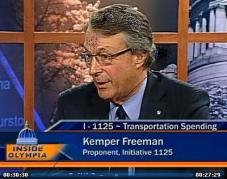
Watch Kemper Freeman Traffic Video In His Own Words – 10 Minutes
Kemper Freeman and Bellevue Residents Willl Stop Light Rail. – CLICK HERE for “Building a Better Bellevue” –
Kemper Freeman Sues Sound Transit over Light Rail in Seattle – Click Here to Find Out Why –
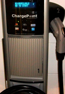
NEW! Kemper Freeman’s 2011 Electric Car Charging Stations at Bellevue Square. *CLICK IMAGE* for Photos and Videos.
More Photos on Tom Lane's Flickr Yahoo Photo Account -

Dr. Peter Gordon’s Blog (USC) on Smart Growth and Light Rail –

How King County Makes Housing Unaffordable, and Punishes Farmers Outside the Urban Growth Boundary –
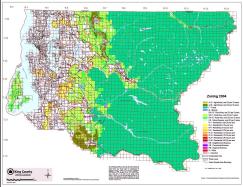
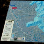
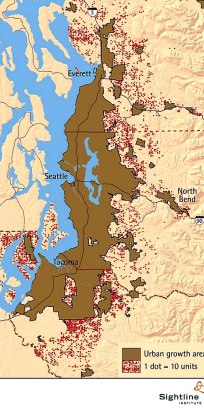
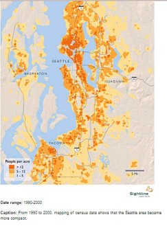
Seattle Urban Growth Boundary Does Not Work – Each dot is 10 building pemits, 1991-2001 – 46,000 total – outside the brown PSRC Urban Growth Area in the Seattle metro. CLICK to enlarge, from Sightline of Seattle, Wa.
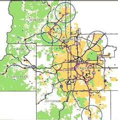
Metro Denver Urban Growth Boundary (“Metro Vision 2035”) – CLICK to Enlarge, from Denver Regional Council of Governments (DRCOG) –
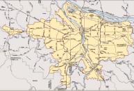
Portland Metro Urban Growth Boundary as of 2006 – CLICK to Enlarge, from Metro of Portland –
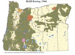
Oregon DLCD Statewide Zoning Map. Hasn’t changed since 1986.
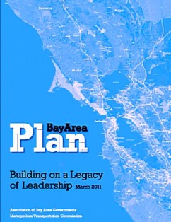
“Plan Bay Area” – High Density Smart Growth Plan – Association of Bay Area Governments
More Growth Maps Below, and from Sightline of Seattle – CLICK HERE –

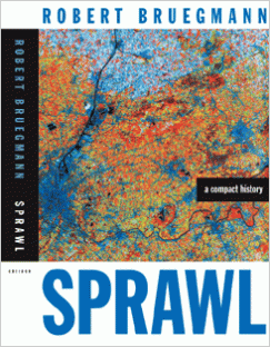
Recommended Reading – Sprawl A Compact History – Dr. Robert Breugmann, Univ. of Illinois –
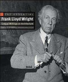
Recommended Reading: The Essential Frank Lloyd Wright, Bruce Brooks Pfeiffer, Ed. 464pp. for $18 on amazon
The Greener Alternative to High Density Treeless Smart Growth – Conservation Subdivisions – book by Randall Arendt
Recommened Reading on Land Use Economics and Growth Management: “The Homevoter Hypothesis…” by Dr. William Fischel of Dartmouth –
Classic 1979 Book on Anti-Growth Restrictions in California Blocking Middle Class Homes – the late Dr. Bernard Frieden – The Environmental Protection Hustle, MIT Press –
Somerset – Active Bellevue, Wa. Neighborhood Association – Incredible Views – Click for Map of Properties –

Click Image for Randall Arendt and Conservation Subdivisions – Alternative to High Density Smart Growth and Traditional Sprawl –
Seattle area Urban Growth Boundary from Seattle – Puget Sound Regional Council, Regional Smart Growth and Urban Growth Boundary, “Vision 2040” – CLICK to Enlarge –

Outside Seattle’s Urban Growth Boundary, New Homes Must be on Five Acres:
Seattle area Population Density Contained within Urban Growth Boundary – CLICK to Enlarge, from Sightline of Seattle –
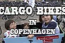
Cargo Cycling Video – Click Image –
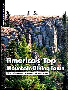
Bend, Oregon: Best City for Mountain Biking, FREE PDF Article from Mountain Bike Action magazine. CLICK HERE –
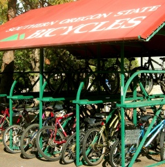
Ashland, Oregon: Southern Oregon University Bicycle Covers. Great idea.
Ashland #1 for Trail Running: Outside Magazine for 2010:

Bend Philanthropic Mountain Bike Trailbuilding: Central Oregon Trail Alliance –
Internation Mountain Biking Association – IMBA – Philanthropic Trailbuilding –
Mountain Bike Review Regional Discussion Boards – Click Image –

Mountains to Sound Greenway: 100 Miles of Trails on I-90 from Seattle to Thorp, Washington in Eastern Wa.

“Friends of the Trail” in Washington State: Volunteers Help Local Agencies Clean Up Waste on Trails, and Even Underwater –

Bob Brinker and Dr. Bill Wattenburg, Click Feb. 2009 Ad for President Obama in the Washington Post –

Gas for $2 a Gallon – With Natural Gas – Write President Obama – Click for Letter from Bill Wattenburg

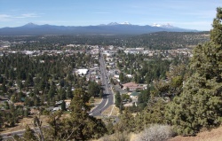
Why Bend, Boulder, Ashland, & Durango will Keep Growing: 5 Million Baby Boomers Moving to Rural Areas by 2020. PDF of USDA Report – Click here –
Familiar landmark, at an undisclosed location, in the Mojave Desert somewhere between Phoenix and Los Angeles.
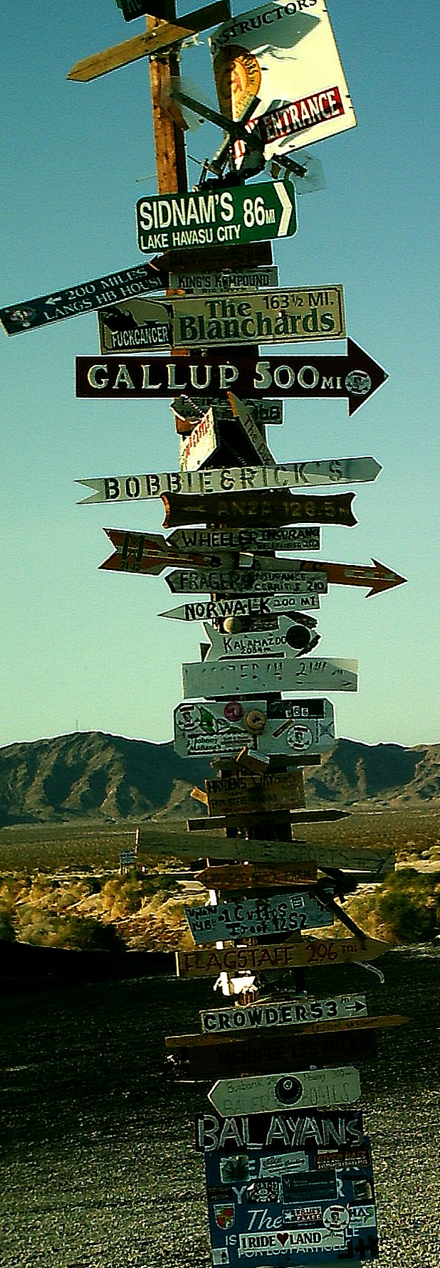
Click to enlarge.
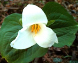
Trillium –
My mission – Affordable Single Family Detatched Housing on Acreage for Everyone –

I also support affordable detatched housing for the GLBT community. CLICK IMAGE for the Human Rights Campaign –

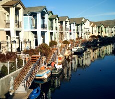
*HOME PAGE* – Click Image of the Sparks Marina near Reno, NV. for the HOME PAGE –
Cancel Obama’s Expensive Smart Growth in 2012 – Mark Levin for President – Housing Affordability for Everyone –

It’s a Bike Rack –
Rio Rancho and Albuquerque, New Mexico. NO URBAN GROWTH BOUNDARIES = AFFORDABLE HOUSING
Salt Lake City – Rio Rancho, New Mexico – NO Urban Growth Boundary = AFFORDABLE HOUSING on LARGE LOTS – More Photos Forthcoming
Mysterious Massive Walls and Clearcutting at Issaquah Highlands … vs. Green Neighborhoods in Arizona and Oregon … Click Here …
Durango Smart Growth – La Plata County Comprehensive Plan – Cancelled (Nov. 23, 2011) – CLICK IMAGE for Plan Maps and Photos –
* NEW * October 8, 2011, Seattle – KEMPER FREEMAN VIDEO – If You Drive, Vote YES on I-1125, Kemper Freeman on TV-W w/ Doug MacDonald

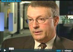
Dr. Bill Eager – “End Gridlock Now” – Stop Seattle Gridlock Today
Kemper Freeman Sues a Third Time over Seattle Light Rail – May 9, 2012
SEATTLE – Why Washington’s Anti-Tolling and Anti-Transit Initiative (I-1125) Didn’t Pass (12/6/11) – CLICK IMAGE of the skyline from West Seattle –

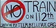
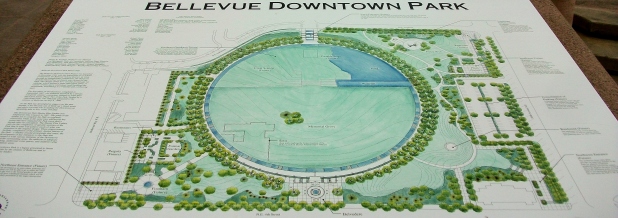
* HEY SEATTLE * – VOTE YES on Kemper Freeman’s Initiative I-1125 – Protect Your Gas Taxes and Tolls – Stop Illegal East Link I-90 Light Rail – Stop the Destruction of Downtown Bellevue with an Ugly Transit Oriented Development -CLICK HERE –

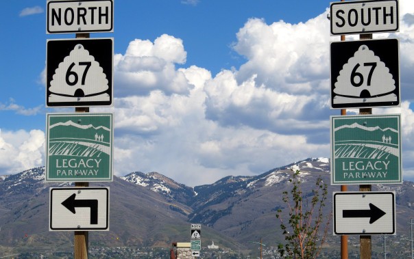
Salt Lake City’s Legacy Parkway – A Green Solution for Seattle Gridlock
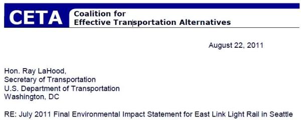
*CETA* Coalition for Effective Transportation Alternatives (Seattle) – John Niles – August 22, 2011 Letter to Ray La Hood advocates Bus Rapid Transit on I-90
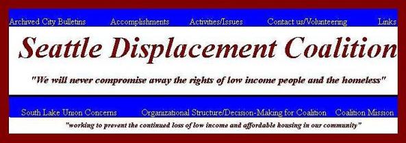
* SEATTLE DISPLACEMENT COALITION * – John Fox and Carolee Colter – Defending Lower Income Apartment Residents against Greedy Smart Growth Developers and Seattle Politicians – CLICK HERE for web site & columns –
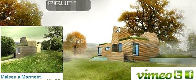
*GREEN ALTERNATIVE * to Smart Growth – *WATCH VIDEO* from Pique Architects – Do They Present Something SIMILAR to the “LANDSCAPE URBANISM” Concept of Harvard’s Dr. Charles Waldheim? Image Source: http://vimeo.com/user4133046/videos – Pique LLC of Bend, Seattle, & Montana –
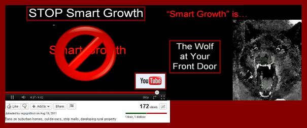
* SMART GROWTH * – The Wolf at Your Front Door – You Tube – (5 Minutes) – Image Source: http://www.youtube.com/user/regsgridlock –
Stop Obama’s Smart Growth … Preserve Organic Farms and Parks on Acreage … We Have No Choice but to Vote Republican … The Truth from Talk Host Mark Levin … Defending Private Property Rights Every Day – Coast to Coast, 3P-6P, Pacific … CLICK for Free Archives.


RR is likely to undergo significant changes in the near future if their economy does not diversify from INTEL. The competition is Singapore and China according to the General Manager of the plant there.