"Smart Growth" and "New Urbanism" Compared with "Large Lot Zoning" (Tom Lane) [ Home Page – Click Here]
(May 17, 2017) – Traditional "Large Lot Zoning" is "Greener" than "Smart Growth" within Urban Growth Boundaries . . . Copyright 2009 – 2017 . . . Tom Lane . . . Photographing California, Arizona, Nevada, New Mexico, Colorado, Utah, Oregon, and Seattle, Washington.
(Jan. 3, 2011) Seattle Smart Growth: Mountains to Sound Greenway (I-90) includes Smart Growth Within Existing Urban Growth Boundaries (UGB’s) – (Part 1)
Under construction
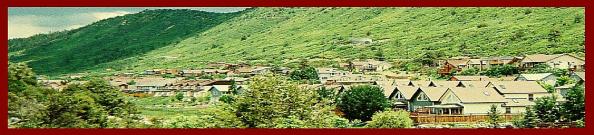
Above: Smart Growth Townhomes under construction at Snoqualmie Ridge, within the isolated North Bend-Snoqualmie urban growth, 30 minutes east of Bellevue on I-90.
Parts 1 and 2 of my series on the Mountains to Sound Greenway along I-90 extending east of Seattle –
Part 1 – (Jan. 3, 2010) Seattle Smart Growth: Mountains to Sound Greenway (I-90) Supports Smart Growth Within Existing Urban Growth Boundaries (UGB’s) – Part 1 appears in this frame below.
Links to Parts 2 and 3 –
Elevation Profile – Mountains to Sound Greenway, from Seattle to Ellensburg (west to east along Interstate 90). From: Scan of “Greenway Adventures, produced by the Mountains to Sound Greenway brochure department: http://mtsgreenway.org/

Western half, from Puget Sound to Snoqualmie pass.

Eastern half, from Snoqualmie Pass to Ellensburg (off the edge of the profile).
Part 1 below –
The Mountains to Sound Greenway extends for 100 miles from downtown Seattle to the City of Thorp in eastern Washington along I-90. It’s also a national scenic byway, and is administered as a philanthropic non-profit organization who sponsors trailbuilding conservation corps and permanent open space acquisition. Thanks to the Greenway, it is now possible to bike, walk, or ride a horse all the way from Seattle to Ellensburg in eastern Washington.
Overall, there are 1.4 millions acres in the greenway, and 800,000 of this is protected; the remainder is urban areas.
The protected lands within the greenway serve as background for several congested high density, smart growth developments within urban growth boundaries, including Talus and Issaquah Highlands in Issaquah, and Snoqualmie Ridge in Snoqualmie. These places are located in the middle of nowhere, with excessive commutes to the Seattle metro, wasting foreign oil. Photos of these developments will primarily be in Part 2.
The Mountains to Sound Greenway does not advocate any design principles of “smart growth” on its PDF guide to building design: http://mtsgreenway.org/newsandpublications/brochures/buildingmtsgreenway.pdf
The Puget Sound Regional Council, and Vision 2040, who administers urban growth boundaries and smart growth, in the four county region around Seattle, chose to designated large isolated areas near Snoqualmie and North Bend as “urban growth boundary islands,” with 30 minute commutes to downtown Bellevue. This is despite closer land near Sammamish, Preston, and along the Redmond-Fall City Road (SR-202), with shorter commutes.
Does the PSRC want to make your commutes longer in this era of increasing gas prices? If so, what is their motivation, given plenty of buildable land much closer to the Seattle-Bellevue metro? Should the Washington Growth Management Act be suspended, and the Puget Sound Regional Council be dissolved, to stimulate construction of homes with yards (not smart growth) closer to Seattle?
And remember, Urban Growth Boundaries are the least efficient solution towards permanent open space preserves, as University of Washington professor Richard Morrill discusses. Since UGB’s are eventually extended, pursuant to population, housing, and business expansion, then previously preserved areas may eventually be designated for 1/10th acre lots.
In addition, land designated as large lot rural properties is not even open to the public in the first place. In fact, under the PSRC, much of the developable land shown in these photos and maps is classified as “rural,” with required large lots. How can this land, along with poorly maintained narrow backcountry roads with no shoulders and no sidewalks (i.e. SR-202, the Redmond-Fall City Road), provide safe recreational opportunities for cyclists and runners?
Of course, philanthropic organizations such as the Mountains to Sound Greenway offer trailbuilding. But the PSRC makes their job harder. If the PSRC had a master plan of residential growth on all buildable lands, in combination with generous greenbelts, trails, and bike paths in rural areas, then the County services such as sidewalks would not suddenly “terminate” every time you move outside the urban growth boundary.
Below, I have outlined the Snoqualmie and North Bend urban growth areas in pink. I have also delineated buildable lands, generally closer to the Seattle-Bellevue metro, in burgundy. However, note that this greenway map only covers a portion of King County, and that much more developable land exists in King, Pierce, Snonomish, and Kitsap Counties, the four counties controlled by the tyrannical Puget Sound Regional Council and Vision 2040. Link: http://mtsgreenway.org/newsandpublications/maps
CLICK to enlarge and then ZOOM to read text:

Annotated map. From: http://mtsgreenway.org/newsandpublications/maps/Ownership2010.pdf Accessed Jan. 3, 2011
And, here’s the map of Vision 2040, showing the four county urban growth boundary, along with isolated areas of urban growth such as Snoqualmie-North Bend and also in many small towns along the Cascade Foothills (i.e. Enumclaw, Maple Valley, and towns in the Snoqualmie and Snohomish Valleys. Link: http://psrc.org/assets/1776/V2040poster.pdf
CLICK to enlarge and then ZOOM to read text:

Vision 2040 Map, PSRC. From: http://psrc.org/assets/1776/V2040poster.pdf Accessed: Jan. 3, 2011
Again, for unknown reasons, the PSRC is forcing long commutes, dependence on foreign oil from countries that want to blow up Israel, and more air pollution, when there is plenty of developable land much closer to Seattle, Bellevue, Everett, and Tacoma. Just like the DLCD in Oregon, this agency operates in such a way to avoid public oversight, and the result is long commutes, heavy traffic, and a diminished quality of life. Those of us with backgrounds in economic geography and landscape architecture have no opportunities to voice our concerns to the PSRC or DLCD, and they have no obligation to respond to our concerns about their performance, or in this case, lack thereof.
Here’s a map I made on a google template of developable lands along the Greenway within the vicinity of smart growth developments Talus, Issaquah Highlands, and Snoqualmie Ridge. As you can see, there are lands closer to Bellevue and Seattle besides Snoqualmie Ridge and North Bend.
Furthermore, extensive areas of developable lands in King County are north of this map, just east of Redmond along the Redmond-Fall City Road, and just southeast of this map, along May Valley Road just east of Renton, and extending further south east of Covington. All of these areas have been blocked from higher density developments by the PSRC, and remain in a rural state with large lot sizes and hobby farms. All of these lands have half the commute distance to Snoqualmie Ridge.
For location efficiency, there is no logical reason for leapfrogging past parks and open space that should remain a part of the Mountains to Sound Greenway. For national security and conservation of foreign oil, we should do everything possible to concentrate developments close to city centers. Instead of smart growth with no yards, a more intelligent approach are heavily treed half acre lots, with linear urban greenbelts with bike trails that serve as open space, instead of large parks of several hundred acres on steep terrain, that are only accessible by foreign oil (i.e. Cougar, Squak, Tiger, and other mountain parks, in the Mountains to Sound Greenway).
For example, here’s a linear greenbelt with trail in Corvallis, Oregon:

Linear greenbelt and trail in Corvallis, Oregon.
Here’s are three photos of systems of linear trails in Eugene, Oregon:

Eugene linear bark covered trail system and adjacent parks in southern Eugene near Amazon Park.

Bark covered trails ideal for trail running in southern Eugene.

Sign of trail system, south Eugene, Oregon.
Here is my rough outline of east central King County. CLICK and then ZOOM to read annotated text:

CLICK and then ZOOM to read text. Annotated Google map by Tom Lane, January 15, 2011.
Here is an image with a wider view than the previous map, from Bellevue to Tanner, Washington, the furthest eastward extension of the PSRC’s Urban Growth Boundary (adjacent to North Bend, in the Snoqualmie River Valley). All the photographs in this post and part two were taken wthin this sattelite view. CLICK and then ZOOM to read text:

CLICK and then ZOOM to read text.
My photos in this post present a photo essay from from Bellevue to Fall City to Snoqualmie to Sammammish, to provide an idea of the local incorporated towns, and, lands that could be developed with much shorter commutes. I like to use views from hills whenever possible to delineate large scale landscape features. Of course, there are only 100 sunny days per year in Seattle, many with heavy fog and low clouds.
First, looking northwest from Bellevue’s Hilltop Community towards downtown Seattle and Bellevue. I-90 and the Greenway both begin in Seattle, and runs east-west at the base of the hill where I’m standing. CLICK to enlarge and then ZOOM to see the two skylines on a rather smoggy January, 2011 sunset:

Looking northwest from Bellevue’s Hilltop Community, with downtown Seattle and downtown Bellevue at sunset, with the Olympic Mountains in the background.

Looking northeast from the Hilltop community. The plateau includes the City of Sammamish, within the Urban Growth Boundary. Beyond the UGB is land just west of the Snoqualmie Valley, including developable land, yet it’s excluded by the Puget Sound Regional Council. Note: Native trees obscure residential development in these photos of Bellevue and Sammamish.

Looking Northeast from the Hilltop neighborhood in Bellevue, towards Lake Sammamish and the City of Sammamish (on the Sammamish Plateau). Again, in this direction, despite developable land and proximity to businesses in Bellevue and Redmond, the UGB terminates at the end of the City of Sammamish.

Looking Southeast over Lake Sammamish from Vasa Park in Bellevue, with Sammamish to the left foreground, Issaquah to the distant right, and Mt. Si in the far distance (?).

From South Issaquah, looking North to Lake Sammamish and the City of Sammamish on the plataeu.

View of Interstate 90, Issaquah Highlands, and the EXPENSIVE new interchange that includes a 6 lane boulevard up 500 feet to the Highlands. Photo taken from an Issaquah cemetery.
Another view of the Highlands from the Talus smart growth neighborhood.

From Issaquah Highlands, looking west, down 500 elevation gain, towards Seattle, Bellevue, Lake Sammamish, and the Olympics at sunset. Very long commute.
“The Edge” of Issaquah Highlands Visble from I-90, with evidence of Clearcutting. Smart growth often involves removal of all native vegetation.

Welcome to the Mountains to Sound Greenway, sign is just after the Issaquah Highlands exit, eastbound on I-90.

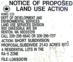
In Preston along I-90. This property cannot be subdivded to smaller lots due to the growth management act. Is that fair? Is it Constitutional?

Rural road near Preston.

Mailboxes for rural residents of Preston, outside the PSRC Urban Growth Boundary.

High Point Trailhead near Preston. The mountains to sound greenway provides highly valued recreational opportunities, although they are dozens of miles from Seattle and Bellevue.

I-90 from overpass in Preston. Strange that the PSRC (Puget Sound Regional Council) allows light industrial (right of photo), along with 6 lanes on I-90 (8 in some areas!), but refuses to allow homes on smaller lots near Preston, and doesn’t widen many 4 lane freeways through Metro Seattle. These anomalies require an explanation from public officials.

Construction at Snoqualmie Ridge, with Mount Si in the background. Note: native vegetation has been totally removed.

Snoqualmie Ridge Development, in the middle of nowhere, 30 minutes from Bellevue on I-90 (that is, with no traffic). CLICK and ZOOM to enlarge.

This location is Northwest of Snoqualmie Ridge, outside the urban growth boundary, along the Redmond-Fall City Road (SR-202). Mount Si in the background, looking southeast. Residents of Snoqualmie Ridge who work at Microsoft in Redmond would take this road. Wouldn’t they rather live closer to work?

A nice farm on the Redmond-Fall City Road. Is it fair to tell them that they can never subdivide their property into smaller lots, due to the Washington State Growth Management Act?

Very few businesses outside the urban growth boundary. This Albertsons, Union 76 Gas, and Mercury Coffee are on the Redmond-Fall City Road. Note to self: if you ever return, get the photo of the Antiques billboard about 1 mile west of this! And find the mountain bike park wherever it is.

Looking NORTHWEST – FROM Snoqualmie Ridge, TOWARDS the developable land BETWEEN Sammamish and the Snoqualmie Valley, including near the Redmond-Fall City Road. Commutes would be much shorter with development on these forested plains instead of on Snoqualmie Ridge. The power lines are headed north to Snoqualmie Falls (Hydroelectric Power).

Back inside the Urban Growth Boundary on the Sammamish Plateau in the City of Sammamish – looking south towards the “Issaquah Alps” from the intersection of SE 228th Ave. and SE 16th Street. SE 228th eventually terminates, to the north, outside the urban growth boundary, among plenty of developable land, against the Redmond-Fall City Road.

The Sammamish Water Tower.

Are these Sammamish Smart Growth condos foreclosed, with the no tresspassing sign, and unfinished street? According to a guy picking up pallets from the area, he thinks they could be. This is the “Pallas” development off of NE 228th, just a few miles south of the urban growth boundary parallel to the Redmond-Fall City Road.

Here is the front of Pallas, showing backyards and fences against the congested NE 228th.

My tour would not be complete, without showing you the Towering Smart Growth Condos at the west end of the Redmond-Fall City Road, in Redmond. These are in the Puget Sound Regaional Council’s Redmond Regional Growth Center. These are ugly, imposing, eyesores for Redmond, and most Microsoft people will commute from Snoqualmie Ridge, as long as gas is cheap. Again, as always, the market and human preferences determines where people choose to live. Note the Sound Transit bus, the same agency being Sued by Bellevue developer Kemper Freeman, for this agency’s illegal plans to build mass transit on I-90.
More Photos of Developments along the Greenway at Part 2 and 3 –
2 comments on “(Jan. 3, 2011) Seattle Smart Growth: Mountains to Sound Greenway (I-90) includes Smart Growth Within Existing Urban Growth Boundaries (UGB’s) – (Part 1)”
Leave a comment

I, Tom Lane, pledge to always be the “Voice of Independence,” in a world dominated by “true believers,” of the ephemeral, and very unpopular, urban planning paradigm, of “smart growth.” I will always advocate family friendly, green neighborhood design, with large private yards, oversized parks, organic gardens, mountain bike trails, and native plants protected by ordinance. Everything must be in harmony with nature, in the grand traditions of designers Ian McHarg and Frank Lloyd Wright.”
Professors Against Smart Growth and Light Rail – The List Continues to Grow – Both Democrats and Republicans –
NEW VIDEO – One Hour – October 10, 2011 – Kemper Freeman and Tim Eyman with Seattle Times Editorial Board –

NEW VIDEO – October 8, 2011 – Kemper Freeman on TV-W “If You Drive Vote Yes on I-1125”
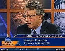
Watch Kemper Freeman Traffic Video In His Own Words – 10 Minutes
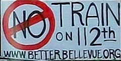
Kemper Freeman and Bellevue Residents Willl Stop Light Rail. – CLICK HERE for “Building a Better Bellevue” –
Kemper Freeman Sues Sound Transit over Light Rail in Seattle – Click Here to Find Out Why –

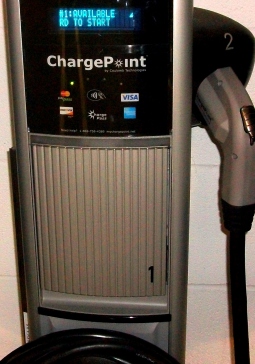
NEW! Kemper Freeman’s 2011 Electric Car Charging Stations at Bellevue Square. *CLICK IMAGE* for Photos and Videos.
More Photos on Tom Lane's Flickr Yahoo Photo Account -

Dr. Peter Gordon’s Blog (USC) on Smart Growth and Light Rail –

How King County Makes Housing Unaffordable, and Punishes Farmers Outside the Urban Growth Boundary –
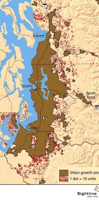
Seattle Urban Growth Boundary Does Not Work – Each dot is 10 building pemits, 1991-2001 – 46,000 total – outside the brown PSRC Urban Growth Area in the Seattle metro. CLICK to enlarge, from Sightline of Seattle, Wa.
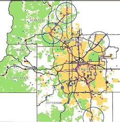
Metro Denver Urban Growth Boundary (“Metro Vision 2035”) – CLICK to Enlarge, from Denver Regional Council of Governments (DRCOG) –
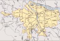
Portland Metro Urban Growth Boundary as of 2006 – CLICK to Enlarge, from Metro of Portland –
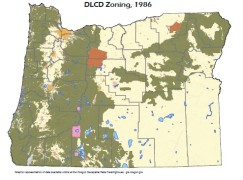
Oregon DLCD Statewide Zoning Map. Hasn’t changed since 1986.
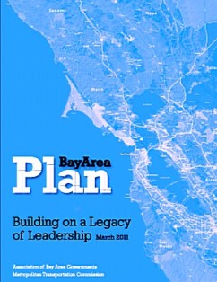
“Plan Bay Area” – High Density Smart Growth Plan – Association of Bay Area Governments
More Growth Maps Below, and from Sightline of Seattle – CLICK HERE –

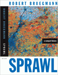
Recommended Reading – Sprawl A Compact History – Dr. Robert Breugmann, Univ. of Illinois –
Recommended Reading: The Essential Frank Lloyd Wright, Bruce Brooks Pfeiffer, Ed. 464pp. for $18 on amazon

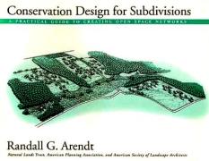
The Greener Alternative to High Density Treeless Smart Growth – Conservation Subdivisions – book by Randall Arendt
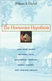
Recommened Reading on Land Use Economics and Growth Management: “The Homevoter Hypothesis…” by Dr. William Fischel of Dartmouth –
Classic 1979 Book on Anti-Growth Restrictions in California Blocking Middle Class Homes – the late Dr. Bernard Frieden – The Environmental Protection Hustle, MIT Press –
Somerset – Active Bellevue, Wa. Neighborhood Association – Incredible Views – Click for Map of Properties –
Click Image for Randall Arendt and Conservation Subdivisions – Alternative to High Density Smart Growth and Traditional Sprawl –
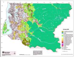
Seattle area Urban Growth Boundary from Seattle – Puget Sound Regional Council, Regional Smart Growth and Urban Growth Boundary, “Vision 2040” – CLICK to Enlarge –

Outside Seattle’s Urban Growth Boundary, New Homes Must be on Five Acres:
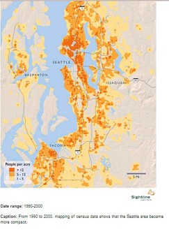
Seattle area Population Density Contained within Urban Growth Boundary – CLICK to Enlarge, from Sightline of Seattle –
Cargo Cycling Video – Click Image –

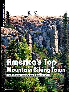
Bend, Oregon: Best City for Mountain Biking, FREE PDF Article from Mountain Bike Action magazine. CLICK HERE –
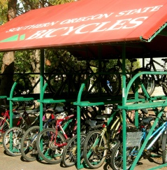
Ashland, Oregon: Southern Oregon University Bicycle Covers. Great idea.
Ashland #1 for Trail Running: Outside Magazine for 2010:

Bend Philanthropic Mountain Bike Trailbuilding: Central Oregon Trail Alliance –
Internation Mountain Biking Association – IMBA – Philanthropic Trailbuilding –
Mountain Bike Review Regional Discussion Boards – Click Image –

Mountains to Sound Greenway: 100 Miles of Trails on I-90 from Seattle to Thorp, Washington in Eastern Wa.

“Friends of the Trail” in Washington State: Volunteers Help Local Agencies Clean Up Waste on Trails, and Even Underwater –

Bob Brinker and Dr. Bill Wattenburg, Click Feb. 2009 Ad for President Obama in the Washington Post –

Gas for $2 a Gallon – With Natural Gas – Write President Obama – Click for Letter from Bill Wattenburg

Why Bend, Boulder, Ashland, & Durango will Keep Growing: 5 Million Baby Boomers Moving to Rural Areas by 2020. PDF of USDA Report – Click here –
Familiar landmark, at an undisclosed location, in the Mojave Desert somewhere between Phoenix and Los Angeles.
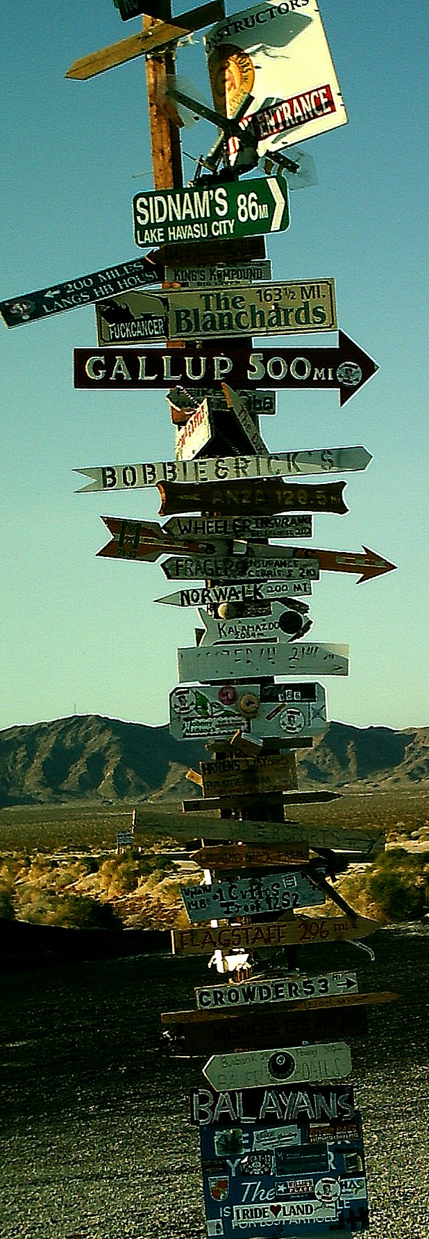
Click to enlarge.
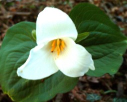
Trillium –
My mission – Affordable Single Family Detatched Housing on Acreage for Everyone –

I also support affordable detatched housing for the GLBT community. CLICK IMAGE for the Human Rights Campaign –

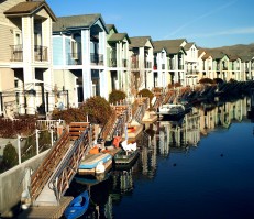
*HOME PAGE* – Click Image of the Sparks Marina near Reno, NV. for the HOME PAGE –
Cancel Obama’s Expensive Smart Growth in 2012 – Mark Levin for President – Housing Affordability for Everyone –

It’s a Bike Rack –
Rio Rancho and Albuquerque, New Mexico. NO URBAN GROWTH BOUNDARIES = AFFORDABLE HOUSING
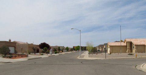
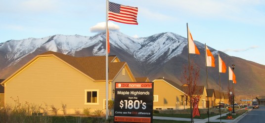
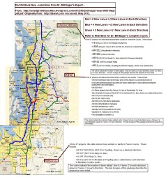
Salt Lake City – Rio Rancho, New Mexico – NO Urban Growth Boundary = AFFORDABLE HOUSING on LARGE LOTS – More Photos Forthcoming
Mysterious Massive Walls and Clearcutting at Issaquah Highlands … vs. Green Neighborhoods in Arizona and Oregon … Click Here …
Durango Smart Growth – La Plata County Comprehensive Plan – Cancelled (Nov. 23, 2011) – CLICK IMAGE for Plan Maps and Photos –
* NEW * October 8, 2011, Seattle – KEMPER FREEMAN VIDEO – If You Drive, Vote YES on I-1125, Kemper Freeman on TV-W w/ Doug MacDonald

Dr. Bill Eager – “End Gridlock Now” – Stop Seattle Gridlock Today
Kemper Freeman Sues a Third Time over Seattle Light Rail – May 9, 2012
SEATTLE – Why Washington’s Anti-Tolling and Anti-Transit Initiative (I-1125) Didn’t Pass (12/6/11) – CLICK IMAGE of the skyline from West Seattle –

* HEY SEATTLE * – VOTE YES on Kemper Freeman’s Initiative I-1125 – Protect Your Gas Taxes and Tolls – Stop Illegal East Link I-90 Light Rail – Stop the Destruction of Downtown Bellevue with an Ugly Transit Oriented Development -CLICK HERE –

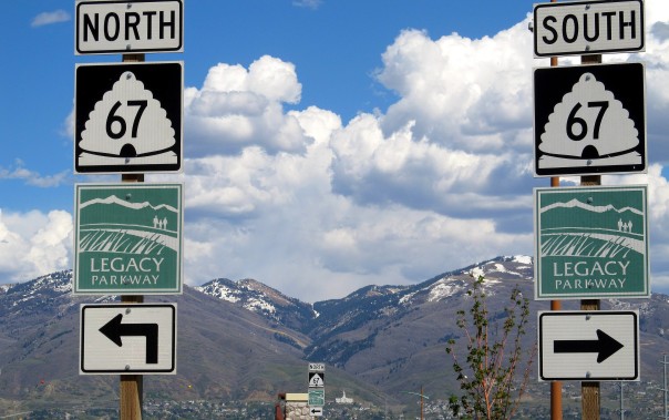
Salt Lake City’s Legacy Parkway – A Green Solution for Seattle Gridlock
*CETA* Coalition for Effective Transportation Alternatives (Seattle) – John Niles – August 22, 2011 Letter to Ray La Hood advocates Bus Rapid Transit on I-90
* SEATTLE DISPLACEMENT COALITION * – John Fox and Carolee Colter – Defending Lower Income Apartment Residents against Greedy Smart Growth Developers and Seattle Politicians – CLICK HERE for web site & columns –
*GREEN ALTERNATIVE * to Smart Growth – *WATCH VIDEO* from Pique Architects – Do They Present Something SIMILAR to the “LANDSCAPE URBANISM” Concept of Harvard’s Dr. Charles Waldheim? Image Source: http://vimeo.com/user4133046/videos – Pique LLC of Bend, Seattle, & Montana –
* SMART GROWTH * – The Wolf at Your Front Door – You Tube – (5 Minutes) – Image Source: http://www.youtube.com/user/regsgridlock –
Stop Obama’s Smart Growth … Preserve Organic Farms and Parks on Acreage … We Have No Choice but to Vote Republican … The Truth from Talk Host Mark Levin … Defending Private Property Rights Every Day – Coast to Coast, 3P-6P, Pacific … CLICK for Free Archives.


Agree with you about more people on one acre lots with wildlife and room for gardens – except – Seattle is already overpopulated you have photos of Eugene and Corvallis on there, seems that Seattle companies could have sattelite offices from these Oregon cities and maybe places like ellensburg, spokane, wenatchee, and yakima.
Do you agree with the overpopulation ideas of the smart growth folks or are you more of the Libertarian type that wants to see cities become the size of Los Angeles
Ryan,
Overpopulation is a subjective term … one person may view a City of a million as overpopulated, while another may think it’s too small, and want 5 million.
I do not agree with the anti-zoning / anti-regulation Libertarian folks who do NOT wish to curb sprwal.
Once a metro region gets to a certain size, air pollution, traffic, crime, and other issues decrease quality of life. This “size” of the metro when this “begins to take place” seems to vary by location. Clearly, both Las Vegas (at about 2 million) and Los Angeles (at 10 million), along with Seattle (3.5 million) have passed this critical threshold.
We can mitigate urban sprwal with greenbelts, parks, natural areas, bike paths, treeplanting, and other features that increase the quality of life. There are lots of volunteer organizations who help improve the quality of life (see the sidebar to this web site).
Agree with you about the sattelite offices for tellecommuting – people can leave congested Portland and Seattle to mountain towns like Cle Elum, Bend, Durango, Tahoe, etc. -Tom/webmaster